Cenas Landsat (em preto) e cartas
topográficas (em vermelho) que cobrem os estados da Amazônia
brasileira.
Landsat scenes (in black) and
topographic charts (in red) that cover the States of the Brazilian Amazon.
![]()
![]()
.
| Monitorando a Floresta
Amazônica
Desflorestamento, aqui, é entendido
como a conversão de áreas
As imagens de satélite, em composições coloridas na escala 1:250.000, permitem identificar alterações em áreas de fisionomia florestal, a partir de 6,25 ha (0,0625 km²). A Amazônia é coberta por 229 dessas imagens (Figura 2) que, visualmente interpretadas, fornecem os limites entre a área de floresta primária e outros tipos de cobertura não-florestal. |
Monitoring the Brazilian
Amazon Forest
Deforestation, here, refers to the
conversion of areas of primary
Color composite satellite images at a scale of 1:250,000 allow the identification of changes in forest cover of 6.25 ha and larger. The Brazilian Amazon is covered by 229 of such images (Figure 2), which are interpreted for the boundaries between primary forest and other types of non-forest vegetation. |
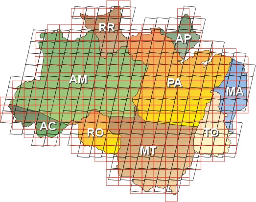
Cenas Landsat (em preto) e cartas
topográficas (em vermelho) que cobrem os estados da Amazônia
brasileira.
Landsat scenes (in black) and
topographic charts (in red) that cover the States of the Brazilian Amazon.
![]()
![]()
.