|
|
|
| Desflorestamento, aqui, é
entendido como a conversão de áreas de fisionomia florestal
primária por ações antropogênicas, para desenvolvimento
de atividades agrosilvopastoris, detectada a partir de plataformas orbitais.
O termo desflorestamento bruto indica que não foram deduzidas, no
cálculo da extensão e da taxa, áreas em processo de
sucessão secundária ou recomposição florestal.
A definição acima exclui áreas de cobertura florestal
afetadas por atividades de exploração madeireira ou por incêndios
naturais, que são temas de relatórios específicos
produzidos pelo INPE.
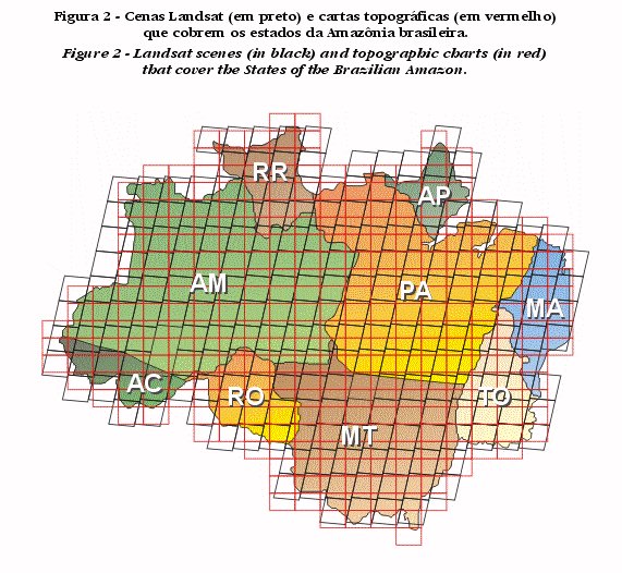
As imagens de satélite, em composições coloridas na escala 1:250.000, permitem identificar alterações em áreas de fisionomia florestal a partir de 6,25 ha (0,0625 km²). A Amazônia é coberta por 229 dessas imagens (Figura 2) que, visualmente interpretadas, fornecem os limites entre a área de floresta primária e outros tipos de cobertura não-florestal. |
Deforestation,
here, refers to the conversion of areas of primary forest physiognomy by
anthropogenic activities, for the development of agriculture and cattle
raising, detected by orbital platforms. Gross deforestation indicates that
areas in process of secondary succession or forest recovery are not subtracted
in the calculation of the extent and the rate. The above definition does
not include areas of forest affected by selective logging activities or
wild fires, which are object of specific reports by INPE.
Color composite satellite images at a scale of 1:250,000 allow the identification of changes in forest cover of 6.25 ha and larger. The Brazilian Amazon is covered by 229 of such images (Figure 2), which are interpreted for the boundaries between primary forest and other types of non-forest vegetation. |
|
 |
||