|
|
|
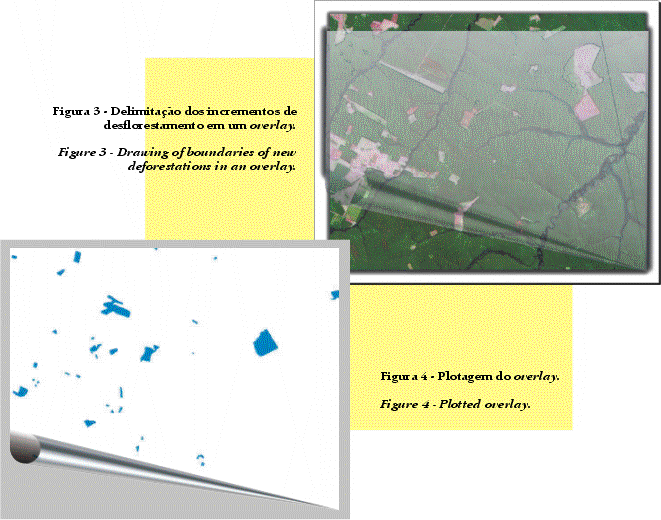
| A cada levantamento são
delimitadas as áreas de novos desflorestamentos, que são
decalcadas em papel vegetal (overlays) (Figura 3), e sofrem uma rigorosa
auditoria. Quando aprovados, os overlays são digitalizados e integrados
a um Sistema de Informação Geográfica, que fornece
a localização e extensão das áreas desflorestadas.
Os dados digitais são convertidos para um formato que permite a apresentação do desflorestamento em qualquer divisão geográfica, por exemplo, tipos florestais, municípios etc. (Figura 4). |
At each assessment,
the areas of new deforestation are delimited.
The deforested areas are outlined in overlays (Figure 3), which are subject to a rigorous quality control. When approved, the overlays are scanned and integrated into a Geographical Information System to provide the localization and extent of the deforested areas. The digital data are converted to a format that allows the presentation of deforestation in any geographical format, for instance, large vegetation classes, municipalities etc. (Figure 4). |
|
|
|
||
 |
||